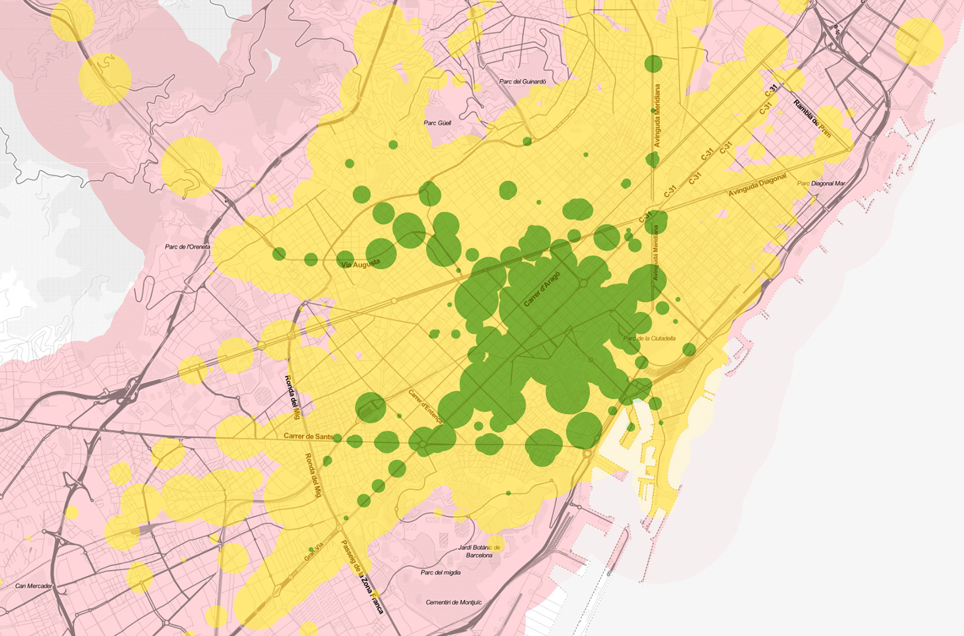
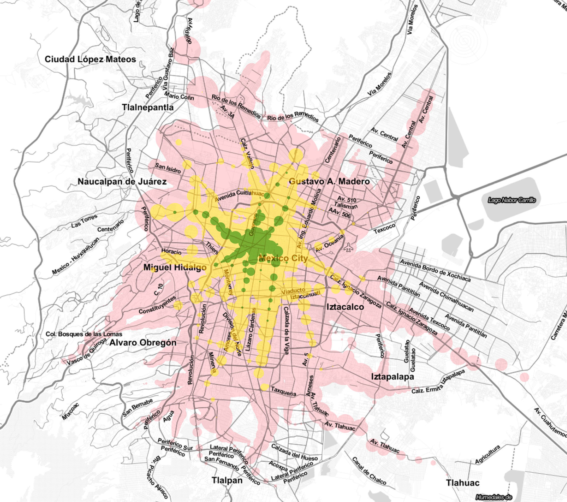
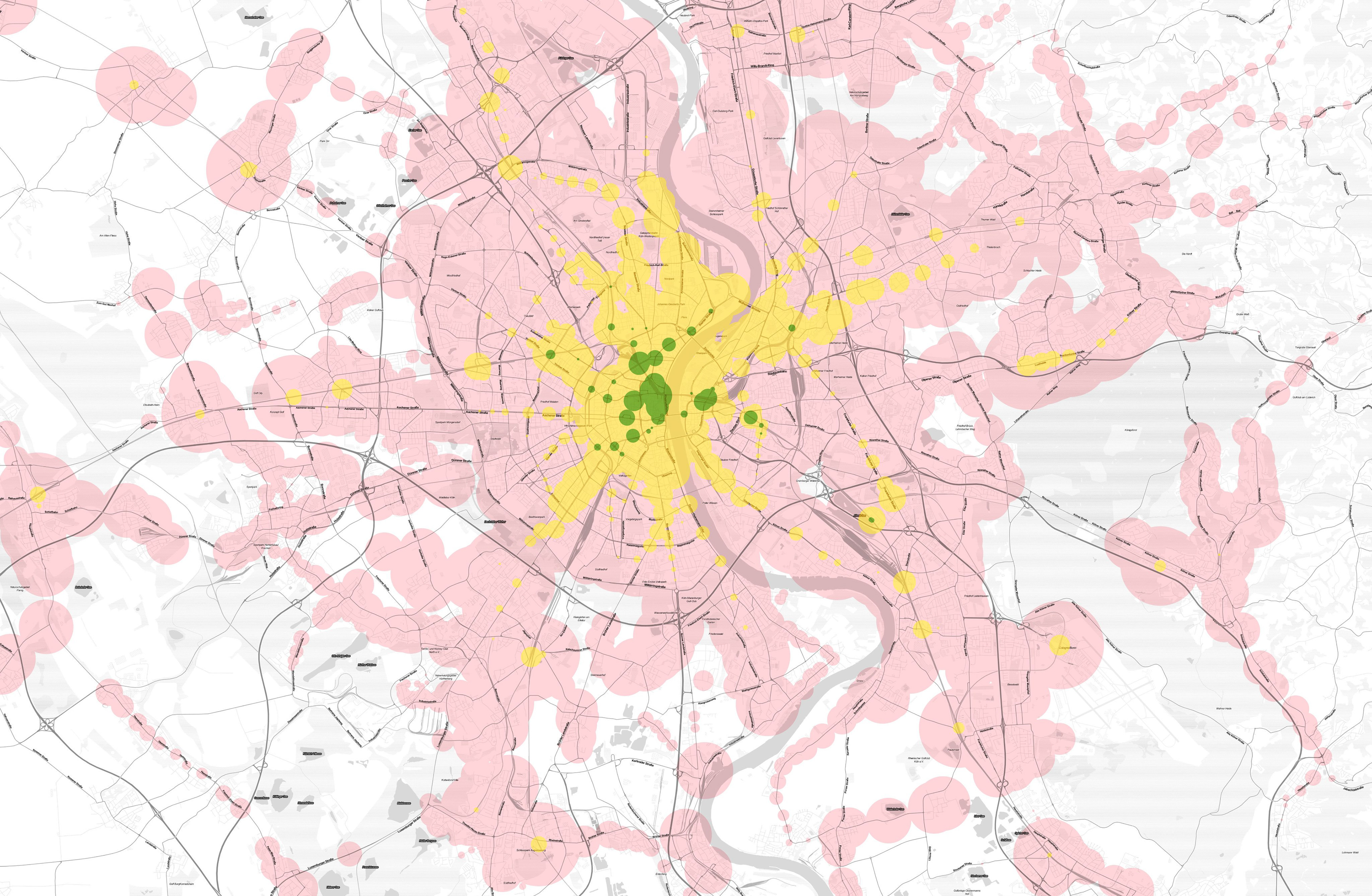
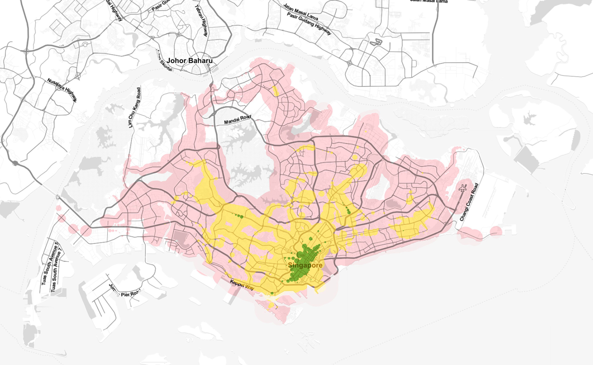
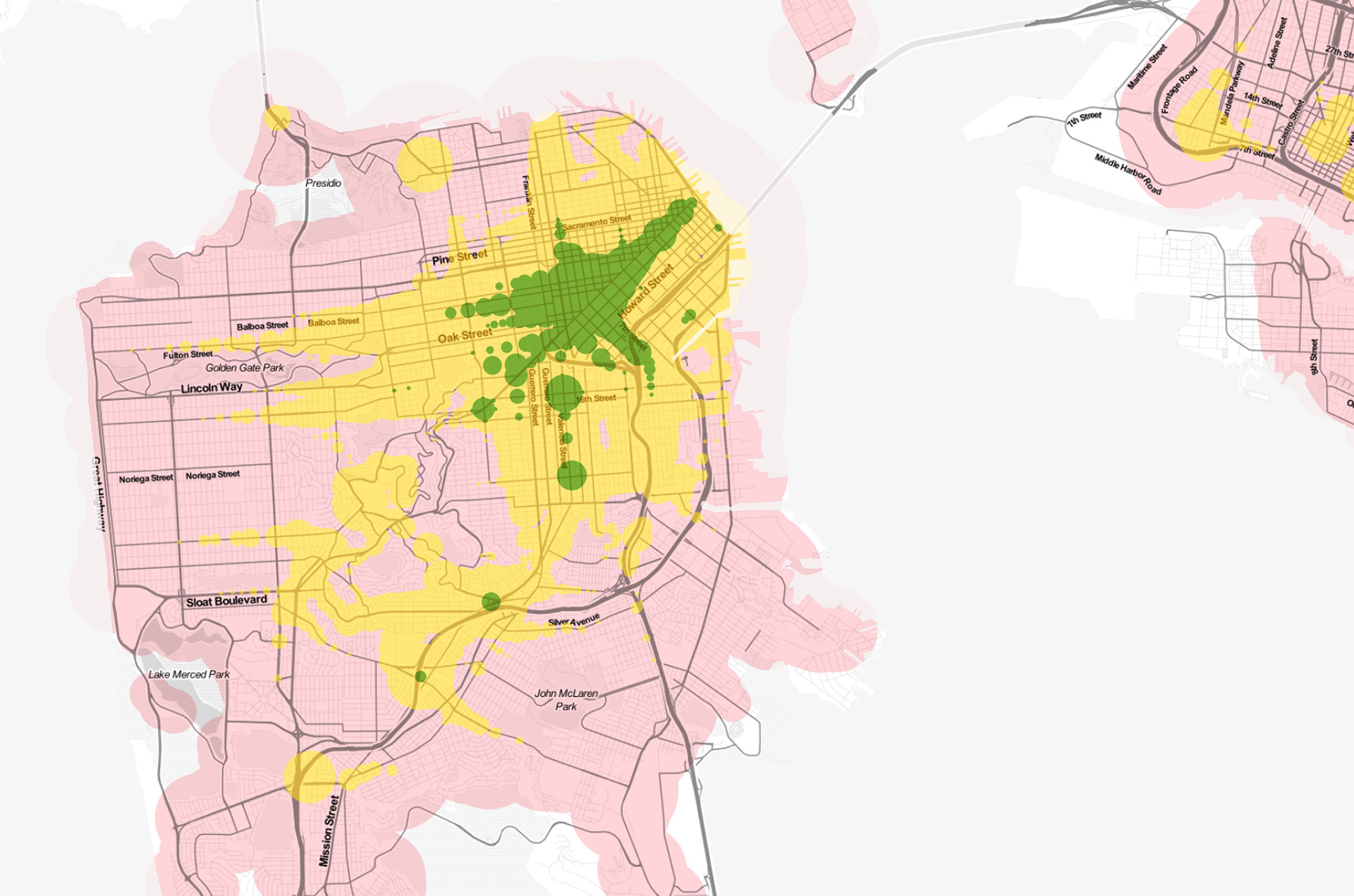
In this project I used an API function by here.com that provides information on the accessibility of areas by public transport from a given starting point, within a given time. I chose a central starting location for each city and added the remaining walking time in a circular shape around each station. Green areas can be reached within 15 minutes on public transit plus walking, yellow in 30 minutes, and red in 60 minutes.